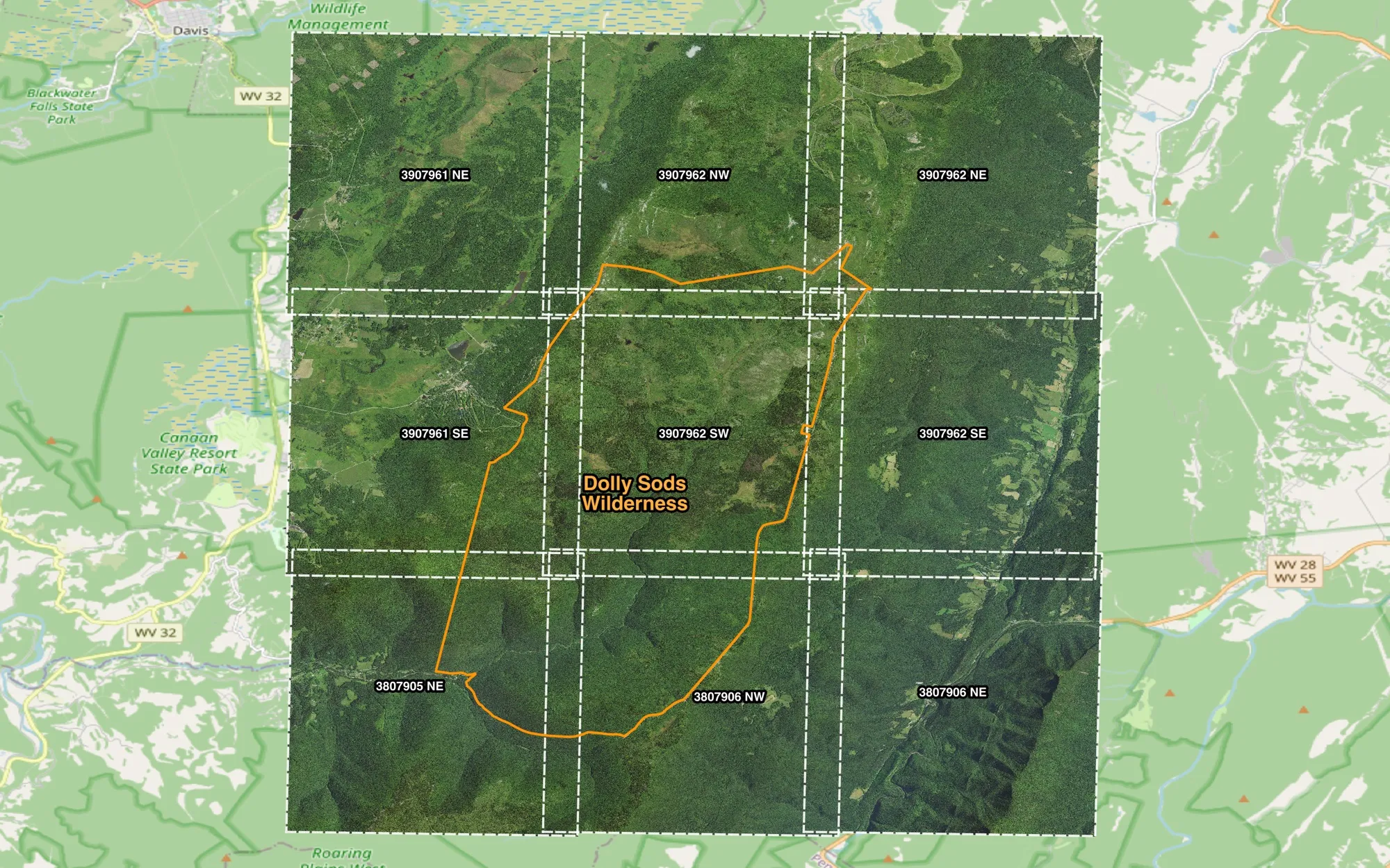
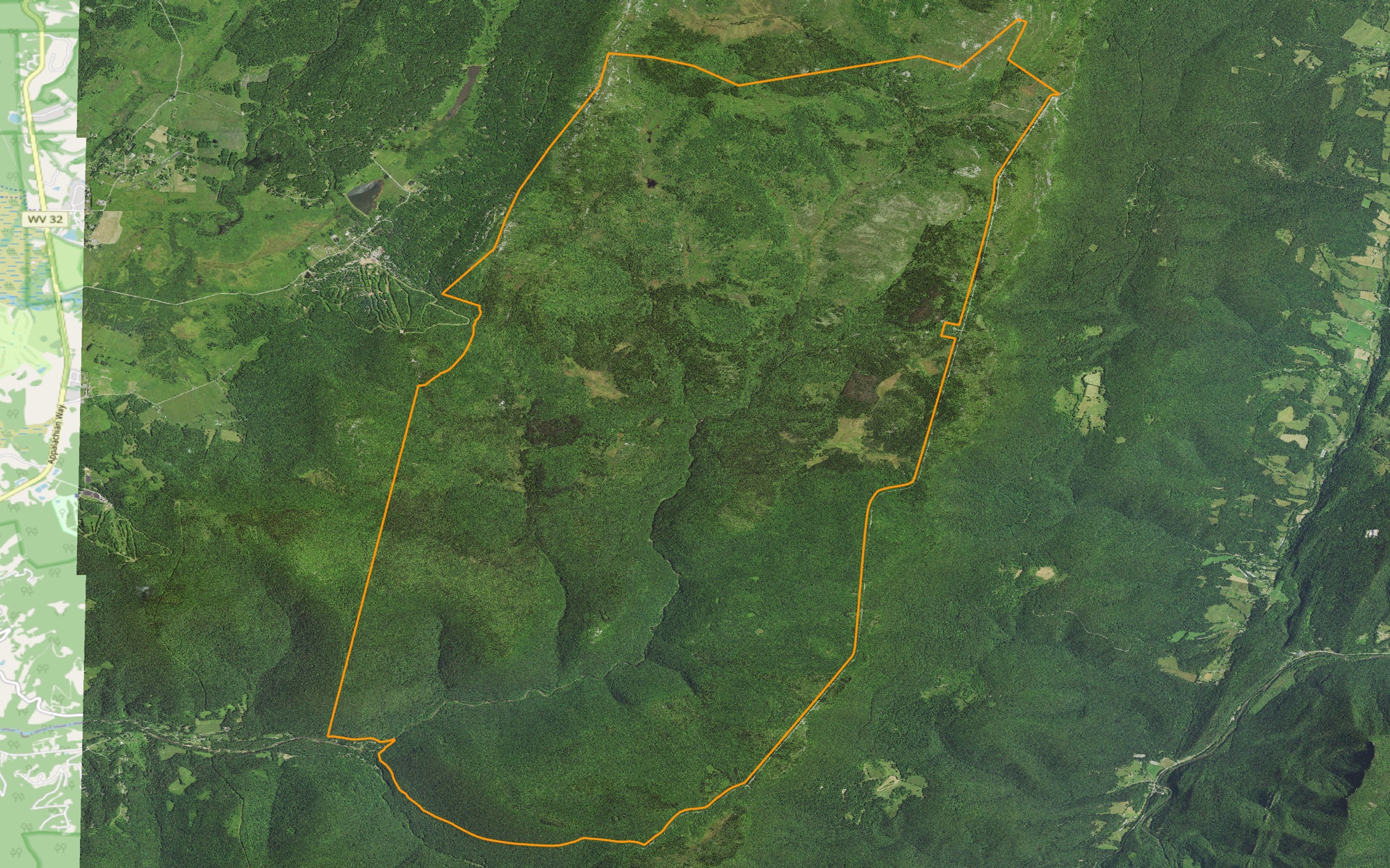
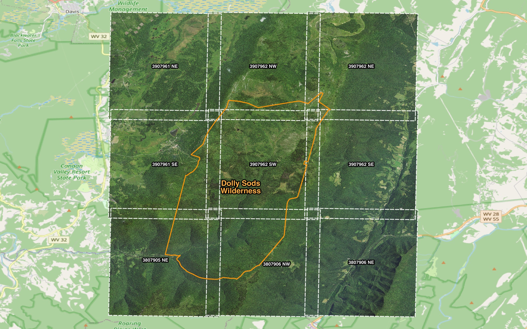
The 9 NAIP tiles (dashed, labeled by tile ID) that a test run found for the Dolly Sods Wilderness area of interest in West Virginia (orange): 2020 imagery at 60 cm.
The National Agriculture Imagery Program provides 60 cm–1 m four-band aerial imagery of the continental U.S. Downloading it in bulk for a study area through the USGS EarthExplorer interface is slow and manual. This pipeline does it from the command line.
Features
AOI-driven: pass a GeoJSON or Shapefile boundary and one or more date ranges.
Size estimate first: reports the scene count and total size, then asks before transferring anything.
Fast: multi-connection, concurrent downloads with aria2c.
Checkpoint and resume: interrupted runs pick up where they left off.
Band extraction: optional GDAL extraction of RGB, NIR or color-infrared subsets.
Uses the current token-based M2M authentication (the password login was retired in 2025), with a YAML config whose settings can all be overridden on the command line.
How it runs
One YAML file configures a run; the pipeline finds the scenes, stages them with USGS and reports the download size before anything is transferred, and the results open straight into a GIS.
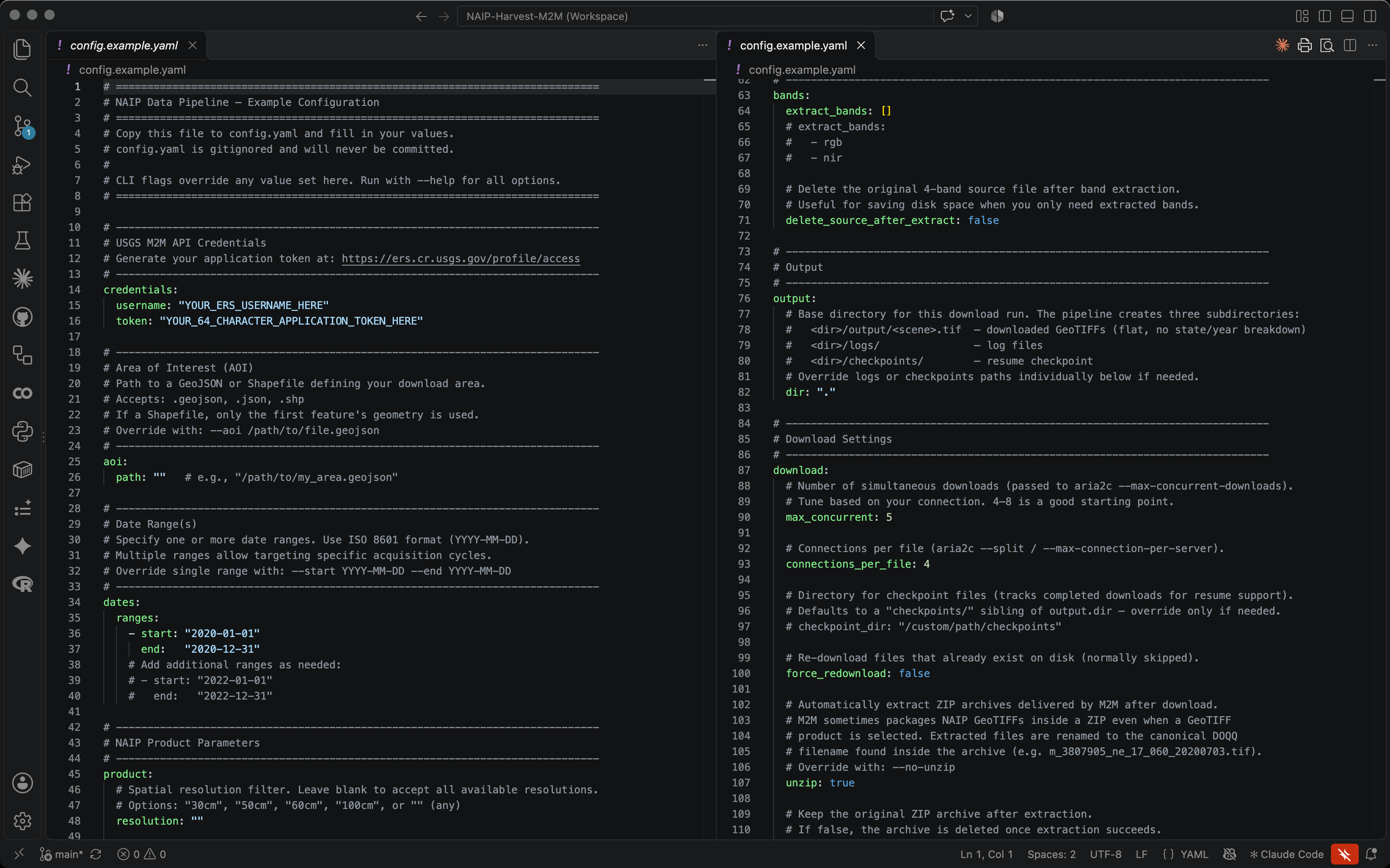
ConfigureCredentials, area of interest, date ranges, resolution, band extraction, parallel downloads, resume and logging. Every setting can also be overridden on the command line.
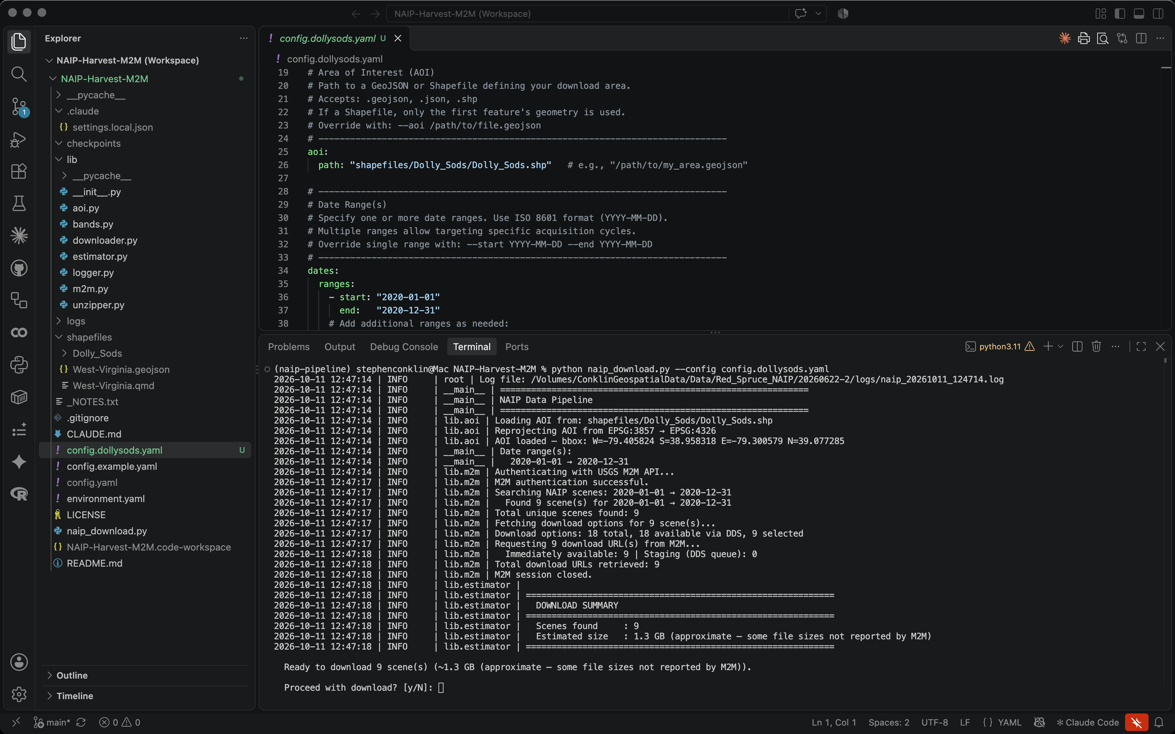
Run: Dolly Sods Wilderness, West VirginiaLoads and reprojects the area of interest, signs in to USGS M2M, finds 9 NAIP scenes for 2020, retrieves their download links and estimates the download size, then asks before downloading.
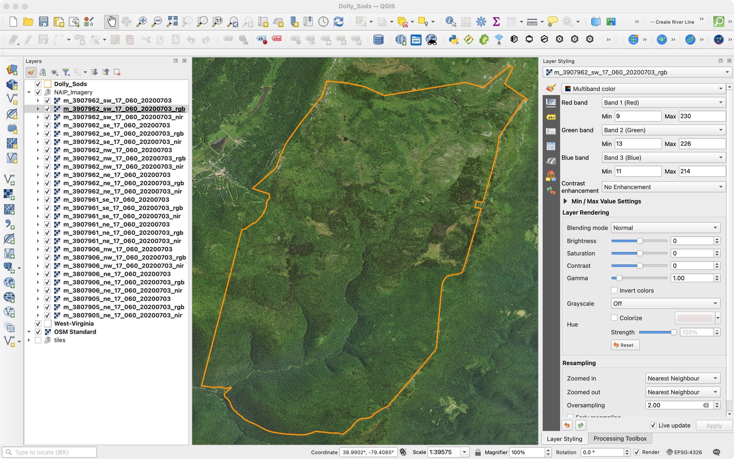
Use: open the results in GISThe downloads open straight into QGIS: each scene as a 4-band image plus its extracted RGB and near-infrared versions, over the Dolly Sods Wilderness area of interest.
Beyond visible light
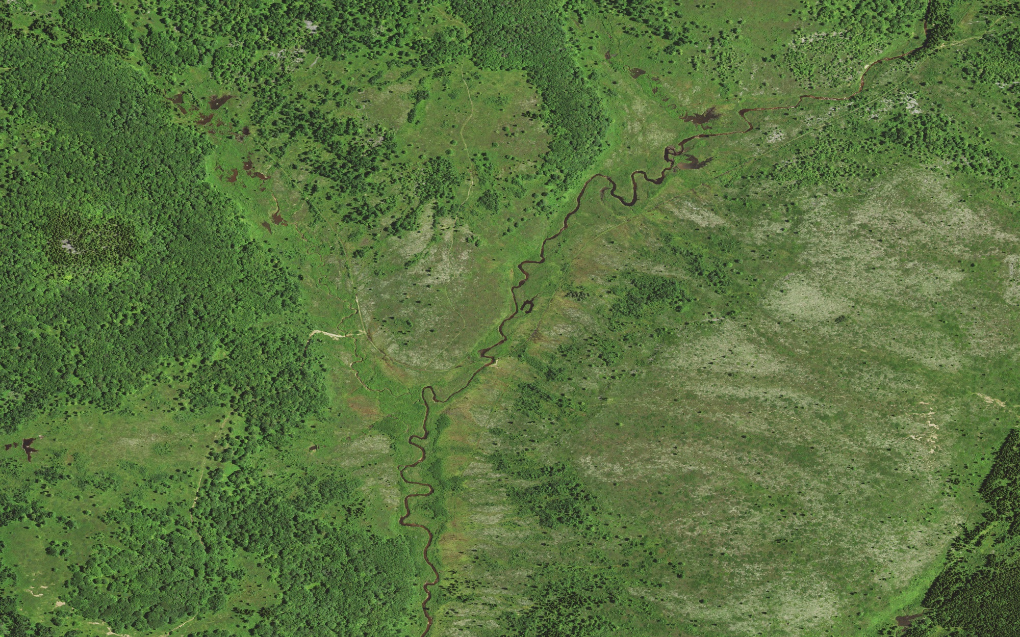
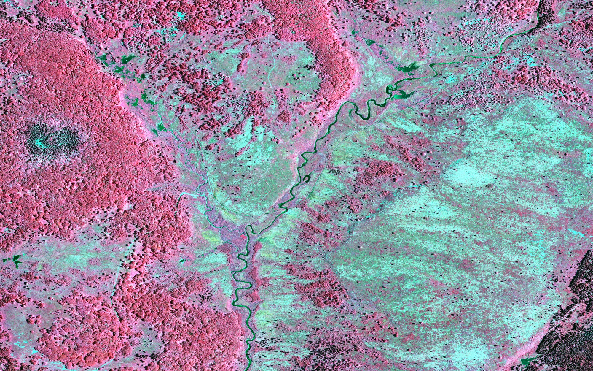
NAIP records near-infrared as well as color, and the pipeline can extract true-color, near-infrared and color-infrared versions of each scene. The same 2.4 km patch of the Dolly Sods Wilderness, two ways.
True colorRed, green and blue, as the eye sees it.
Color-infraredNear-infrared shown as red: healthy vegetation glows red, while open heath and bare ground turn pale.
Detail at 60 cm
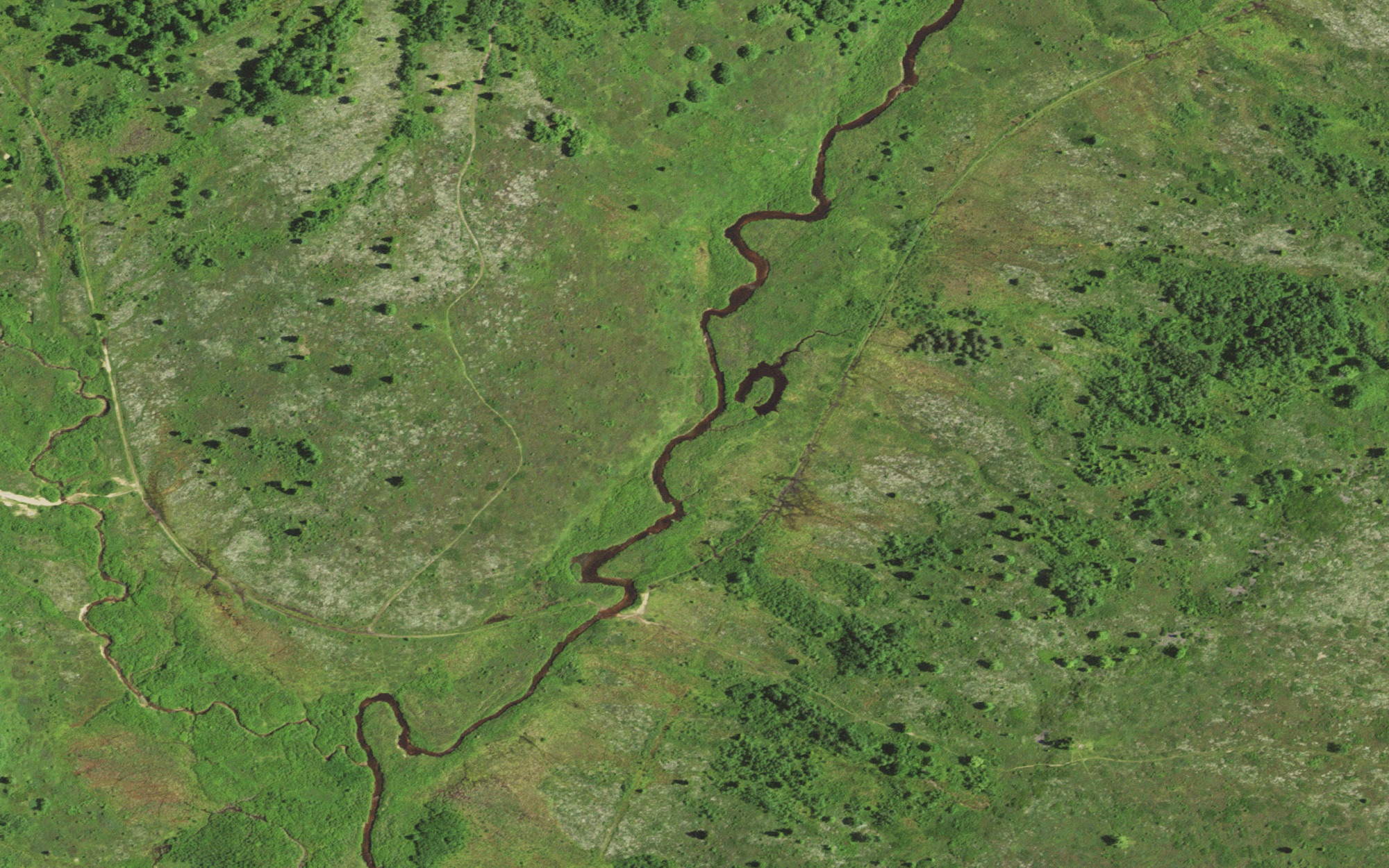
Each NAIP pixel is 60 cm across, enough to pick out individual trees, a meandering stream and faint trails.
Close-up, about 1:1,600A stream meandering through open heath and scattered trees, about 850 m across.
Maps
NAIP coverage: Dolly Sods Wilderness, West VirginiaThe 2020 NAIP imagery (60 cm) downloaded for the Dolly Sods Wilderness area of interest (orange), shown in QGIS. At the left edge the tiles end and the basemap shows through.Nine scenes, one area of interestThe 9 NAIP quarter-quad tiles the run found (dashed, labeled by tile ID) covering the Dolly Sods Wilderness area of interest (orange).